
Canada, and some things leading up to it.
I’ve been struggling with a kind of writer’s block to write an intro post for this summer’s trip. But I’ll take a stab at it.
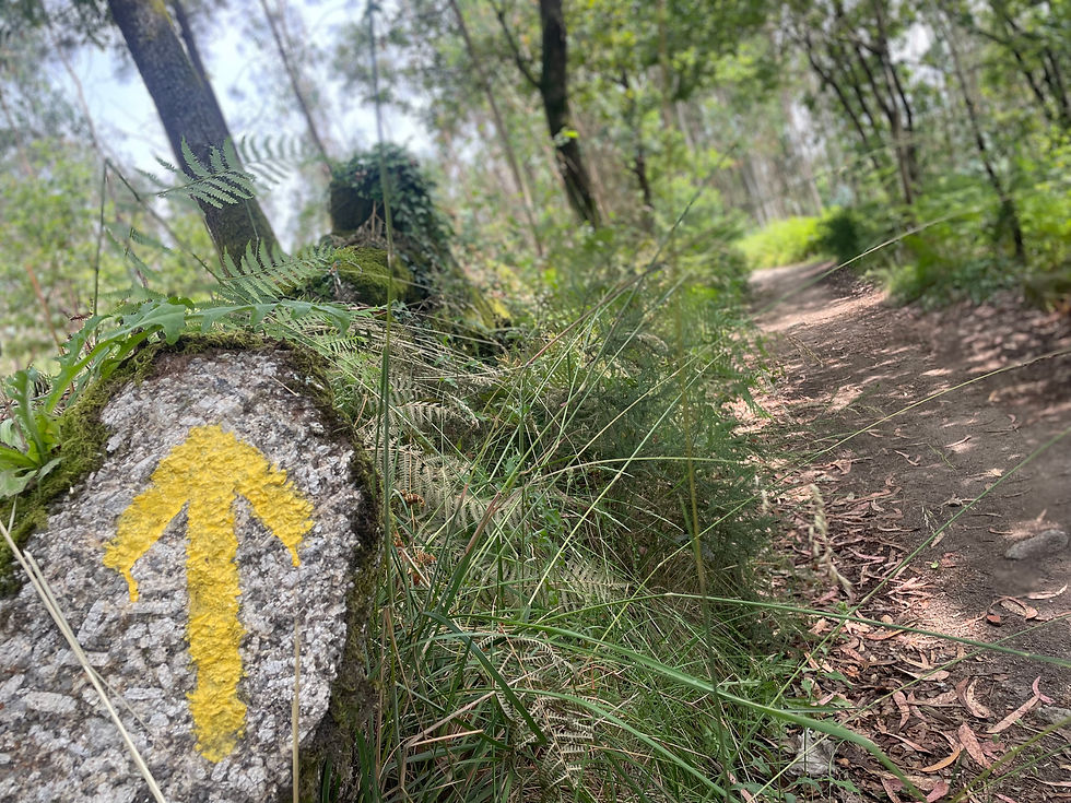
I didn’t do a big hike last summer-just a couple weeks on the Portugese Camino, which was pleasant but not particularly athletic.
Instead, I spent about 7 weeks in Colombia, first in Cali and then up on the Caribbean coast. I regret not writing a daily blog of that experience, which I should remember for the future-go ahead and write it down, even if it’s not seeming to fit with what you’ve been doing.


In the fall, worked a 13 week travel nursing contract in the Bay Area and then came home to Bishop in December. It was a relief to come back to the people, job, and life that I’ve settled into, although there are predictable annoyances and little stressors.
Filip and I reconnected, and disconnected. The content of that is not appropriate to share on this public blog. It was sweet to have a few more moments with someone with whom I had connected so deeply.

In April, I began to train with consecutive weeklong hikes for a very big, committing trip in northern Canada in August. But to my dismay, my old knee injury that I originally sustained on the Appalachian Trail in 2009 came back to haunt me. I believe not doing a big trip last summer set me up for this old demon to come back to haunt me. I hiked 2 days on the Appalachian Trail near my parents’ house in Virginia the beginning of April before it became clear I had a problem.
“Day 1 10.2 miles
I get on the trail near Troutville Virginia and start walking northbound. It’s cold and sunny. Everything is still brown, with a gild of light green-just around the edges.
I’m tired from 6 night shifts at the hospital and the overnight flight to the east coast. Something, also, feels dysregulated in me- like I haven’t landed here yet. I sit down at a bubbling stream and take a nap in the sun, just listening to the little songbirds and the wind in the trees. When I start hiking a bit later, another hiker comes the other way- he has the lithe easy legs of a thruhiker, but his eyes are sad- and for a moment I wonder what his life is like around the trail- where he came from and what he has to go home to. “No water at the next shelter, or the one after,” he tells me. “Long dry stretch.” Looking at the map; I believe this-the trail parallels the Blue Ridge Parkway and the ridge of the mountains for some time. And yet, I smile as I pass three streams in succession after this- his standards of a dry stretch might be different than mine after all these years of living in the West.
I come to a shelter in the early evening and settle in. My old knee injury is talking to me, better not to push it.
As the sun is going down, a young man comes up the trail. He’s thruhiking northbound and started in February, and just got out of the Air Force. He settles in at the other end of the shelter as it gets dark, the wind in the trees making far away comforting noises. Everything is ok.”

Everything was not ok. The next morning, my right knee had blown up to twice its size, and was painful to walk on level ground even without a pack. I knew I had to change gears. My dad came and picked me up on the Blue Ridge Parkway and I headed back to my parents’ house.
Going home to Bishop, I was helped out exceedingly by Dre, Physical Therapist at Shift Physio. I can’t even really describe the comfort of being cared for in a mountain town, by another mountain athlete-and this was compounded by having a visit with Dr Michael Karch, orthopedic surgeon who incidentally is the official MD for the US Olympic men’s ski team- he asked me, “do you think I could hike or run the Continental Divide with a horse and two mules?” He gave me a steroid shot that calmed things down enough to give the physical therapy time to kick in. I hiked the famous Paria Canyon walk in Utah with beloved friend Christa, the first week of May.


The next week, I hiked most of the Low to High Route.
Day 1
Leticia drives me out to Badwater Basin from
Bishop, about a 3.5 hour drive. It’s a beautiful drive that I’ve done many times- and roughly follows my hiking route on the highway-I note the huge temperature swings as we drive. By the time we make it to Badwater Basin, it’s about 90 degrees and the sun is going down. I hope it cools down a little tonight. I hike just about a kilometer and decide to set up my tent-it’s already dark, the stars popping out around the little slim crescent moon over the mountain range I’ll climb tomorrow. I miss Filip intensely in this place-we were just here together 3 months ago; now Badwater basin is completely silent, except for a few wind gusts through the night.
I don’t sleep well- I’m flipping from night shift just last night and the first night is always hard, plus where I decided to put up my tent was not optimal-lots of rocks and pointy things, on a slant. I sleep about 7 hours and wake up at 5:30 am- right this second, it’s a reasonable temperature, but I know that won’t last. I’ve got to gain some elevation before it becomes stupidly hot. The sun clears the opposite mountains over the salt flat, already white and blistering, which immediately clears me out of my tent. I start hiking at a good clip up the dirt road towards Hanaupah Canyon.
I don’t feel really great, but mercifully my knee is doing just fine. I carried 5 liters of water in with me and have about 4 left, plus 4 days of food-a little bit of a heavy carry. There should be water about 8 miles in at Hanaupah spring.
I just got a fitness watch, which just adds a lot of objective data to how I’m feeling. I’m so deconditioned- my heart rate stays in the 150s for hours, and by the time I get to that spring I feel pretty shaky, nauseous, covered in a thin film of salt from dried sweat. The spring is bubbling happily, cold clear water-so I pump 3 liters, drink a liter, and take a nap under my sun umbrella for a couple hours. I manage to eat some dates, a nut butter pack, and a bread roll-that’s all I can get down, but it’s about 500 calories, not bad.
I start the ascent up the ridge towards Telescope Peak at about 3:30. It is almost vertical, and cross country. I know this part will be excruciatingly slow, but actually I’m having a lot of fun with it-I haven’t done anything this technical probably since Slovenia. I slowly haul myself up onto the ridgeline-it’s now 5:30 pm. I just gained 1500 feet in 2 miles. That’s enough for today-there are some nice campsites right at the top of the first steep climb. I still have 4800 vertical feet over 4 miles until the high point under Telescope-this route has its crux right out the gate. I set up my tent happily with a mindblowing view of the surrounding peaks, and tiny Badwater basin 5300 feet below me with its white salt flats. I make a freeze dried “biscuits and gravy” for dinner, 1100
calories-try and make up some of this deficit so I don’t bonk tomorrow. The peaks turn pink and gold with the setting sun. It is much, much cooler up here. I think I’ll sleep a lot better tonight. I hiked 10 miles today, gaining 5300 feet.

Day 2
I slept for 9 hours, cozy in my tent. The only minor downside was that I had to wake up at 3 am and reinflate my sleeping pad-it’s got a slow leak, or the valve isn’t working. I’m about done with these Thermarest yellow pads-this is about the 4th one I’ve gone through in recent years.
I pack up and continue the ascent, which first goes over some small mini hills before it gets really steep again. I’m kind of aware that I don’t have a ton of water for this-maybe 2 liters. It isn’t too hot, but it’s cross country uphill travel and a lot of work, and I’m wanting to drink a lot.
The grade steepens and it’s bushwhacking up a steep slope, trying to find the best angle of travel, pushing through trees with dead branches, etc. I am going painfully slow. I feel alright, but I’m just out of shape, and even in the best of times I’m slow at this kind of travel. The TX4s once again save the day-they are such great shoes, I can’t believe La Sportiva discontinued them. They grab onto rock so well and tolerate me continuously kicking steps into the loose scree.
I take just a 10 minute break to eat a roll and nut butter pack, washing it down with just a couple sips of water. This is getting not great with the water situation. It’s a tough balance, because if I had hauled more water up here, I’d probably be going even slower.
I finally break tree line and stare up what feels like an almost vertical scree field, to the ridge. The mileage left versus how many feet elevation I still have to gain kind of breaks my brain, but I just try not to think about it.
As I climb, slowly kicking steps into the scree-my least favorite kind, feels like the whole mountain slides down a little when you take a step-I feel all of these negative reels playing in my head of what feels like failures in my past- failing the Mountaineers Intermediate exam all those years ago, my breakup with Martijn, Katie and Sergey leaving me on the Yellowstone loop at the end because they were tired of me going slow, the same thing happening with half the group in the Sierras on the PCT in 2023 in the snow. At the same time, I feel surrounded by angels cheering me on- Joey, who would have loved this, and my spirit guide- it’s strange how I feel both of these so strongly as I climb.
I finally crest the ridge at 3:33 pm. I am so, so thirsty-I just keep having visions of the most delightful refreshing drinks-grape soda, and limeade, and the mango chili popsicle Christa bought me last week after Paria Canyon- so I immediately just start walking down the Telescope Peak trail towards Thorndike Camp, where I cached my water, 5.3 miles down. I sit down about halfway through this and try to eat a granola bar-but I can’t stomach how dry it feels in my mouth. I try and squeeze a few more drops of trapped water out of my Sawyer filter directly into my mouth- the few drops relieve me for a moment. I finally get to the camp at about 6 pm. I dig up my 2 gallon jugs of water from under a tree-it is such a relief to see them still there. I sit down and immediately gulp down 2 liters. I imagine how strange I must look-toddling unsteadily into the camp with my dirty pack, digging a hole in the ground, pulling up two dirty jugs, sitting on my butt and dumping the water directly into my mouth.
There are 2 other people camped here. I choose a site and set everything up, make dinner and tea, settle in. This was kind of a brutal day, but I’m really proud of myself for climbing 10,000 vertical feet in 2 days. I hiked 11.5 miles today. I climbed 5000 feet.

Day 3
I wake up listening to a funny argument at 6 in the morning-the middle aged couple in the tent next me.
“It’s gonna rain today. Those are cumulo-nimbus clouds. They mean rain.” (The man)
“It’s not going to rain. We’re in Death Valley.” (The woman)
“Listen, I know weather. I know clouds. It’s going. To rain.” (The man)
This goes on for maybe another hour. When I finally stick my head out of my tent and look at the sky, I laugh a little-those really are clouds that usually predict rain; I agree with the man on this one.
I pack up and start walking down the road towards Wildrose camp. It’s cool and pleasant. I’m looking to hitch this next section to Panamint, if I can- it’s almost 100% Jeep roads and 6000 feet loss over about 27 miles, not awesome for my knee especially after that insane exertion the last 2 days, and kind of junk miles. The thruhiker in me fights the notion of not hiking a “pure” hike but reason needs to lead on this one- I’ve got an entire summer of mountain adventures that it would be dumb to ruin with a 27 mile road walk.
I make my way down the road and pass the Wildrose charcoal kilns, left over from mining in the late 19th century. They still smell like smoke inside, amazingly. As I walk, I get passed the other way by an old Camry with Vermont plates- I wave, then think, “bold move, driving up here with that car.” I didn’t bring my Honda CRV past Thorndike camp when I was putting in my water cache because the road degrades and gets really steep. About an hour later, I hear the car coming back the other way, and I put my thumb out-the car pulls over-it’s an adorable couple in their early 20s, on their summer break from college and doing a road trip across the country. The back seat of their car is absolutely crammed with stuff and there aren’t any seats, but we manage to move enough stuff for me and my backpack to cram in and off we go. “This car has almost 200 hundred thousand miles on it,” the guy proudly tells me. “But it really needs an oil change. So we’re going to Ridgecrest for that, plus motels are really cheap there, and we really need a shower.” They are utterly delightful. When they drop me at Panamint Springs, they refuse to take any cash for gas-I don’t usually offer money for hitches, but this felt warranted-I’m left with such a warm feeling about these pockets of goodness all over the place in humanity we can find.
I go into the general store, and the guy working the counter says, “Low to High? Here for your box?” I had left a box of 3 days of food for the section to Lone Pine, which he retrieves for me. I ask about cabins, and he produces one for $50 less than was listed online-price change, or hiker discount. I have some lunch in the restaurant and then pass out in the air conditioning in the cabin all afternoon. The rest of the day is catching up with everyone back in bishop and relaxing. Every time I briefly exit my cabin or the restaurant air conditioning into the 100 degree heat, I’m thankful for my decision. I hiked 4 miles today, and hitched 23 miles.

Day 4
I get up and start hiking at about 6:45 am, trying to get out of Panamint Valley before those 100 degree temps return. It’s quiet and beautiful around the resort at this time- the sun just cresting the mountains and turning everything golden. I really like this little resort in the middle of nowhere. Every single person has been incredibly kind and personable.
I walk down the road and turn down Darwin Canyon-then scramble up the first plateau on a pretty gentle little 500 foot scramble. I’m not doing the Darwin Falls alt, although it seems like just about everyone else does. I don’t need water, and I don’t really want to deal with the class 3 scramble to get off the falls and back on the route.
The Darwin Plateau, which I’m now on, spreads out massively in every direction. It’s covered in volcanic rock, which I don’t really realize at first and ultimately end up cursing every step. It’s all of these softball sized black rocks, too small to hop between-so you just end up having to really watch where you’re stepping so you don’t turn an ankle. It reminds me exactly of the Pennsylvania rocks on the AT-exhausting to walk on. This entire plateau is covered in it, and the route gently slopes upwards for around 9 miles. The advantage of this is that I’m gaining elevation and it’s not getting much hotter.
In the early afternoon I finally make it to Saline Valley road and my water cache. It’s hot from the sun and kind of tastes like bath water, but I’m still kind of traumatized from
running out of water 2 days ago, and I drink it happily. I continue walking the road for around 7 miles and finally wearily set up camp around 6:30 pm among some Joshua trees. I hiked about 18 miles today. I gained 4000 feet.

Day 5
I did not sleep particularly well last night, due to a curious burro that kept sniffing around my tent in the middle of the night. I was a little freaked out at first- it was just me in my tent, in the middle of nowhere amongst the Joshua Trees- until he started “hee haw”-ing loudly. Then I laughed and tried to go back to sleep.
I start hiking at 8 o clock and continue down white mountain talc road, almost flat. It’s already hot. I get to my water cache at 5 miles in then continue on. This section is just miles and miles of dirt roads. The road slowly loses a thousand feet elevation then goes up 3000 feet. I opt to take the standard route rather than the Cerro Gordo alt, which goes almost the top of Cerro Gordo peak.
I’m feeling pretty trashed in the early evening, climbing slower and slower. I realize I’ve already hiked like 18 miles. But my water is cached at Cerro Gordo ghost town, at the top of the climb, so I have to keep going. When I was putting my water caches in a month ago, I drove up to the ghost town with my Low 2 High hitch hiker Matt that I had snagged in Lone Pine-there was a really nice worker there who told me I could put my water in the old historic sheet metal church. So as I am hiking now, exhausted, I’m not sure if anyone will be around, so I figure I’ll just grab my water and walk down the road a little ways.
I crest the hill and look back at the mountains I just walked through-they look like a dream world in the evening setting sun. I’m so, so tired, but as I trip my way down towards the ghost town, a truck and a four wheeler are coming down the same time. In the four wheeler is the guy I met a month ago- Avery, who lives and works here. “Well we just had a big race yesterday that ended here. So we have as much water as you want, plus soda and snacks. Do you want to stay in the bunkhouse with the volunteers?”
I feel my smallness; my tiny dirty body and backpack against this foreground of mountain, and history, and social context.
I don’t have to think twice about that. He shows me to one of the historic buildings on the property and I choose a room. A little while later, a bunch of the volunteers come back from a mine they were exploring- they have a whole bunch of beautiful and interesting rocks that they found. One of them says to me, “Low to High? How’s it going?”
I consider. “Honestly, it’s kind of kicking my ass.”
He grins. “Sounds about right.”
Later I realize that this man was Brent Underwood, the owner of Cerro Gordo ghost town, famous on YouTube.

I make dinner on the porch and chat with a few of the volunteers. I learn that the owner, Brent, has a YouTube channel about this place called “ghost town living.” There is no cell service up here to look it up.
I am utterly delighted by how friendly these folks are. It’s like this little utopian community in the middle of nowhere, and I am just folded in as part of the scenery. “Oh yah those low to high hikers, they come through here.” As much as I love the solitude of hikes like this, it is these sweet authentic interactions that warm my heart for weeks and months to come.
I fall asleep as the last of the light disappears behind the distant Sierras. I’m so close to Owens Valley now, this is the last line of mountains to cross. I walked 21 miles today. I gained about 3500 feet.

Day 6
The next day, I walk down the auto road and hitch with a German tourist the 8 miles from Keeler back to Lone Pine. I’m still planning to climb Whitney to complete the route, but pick up my car to run home-I pick up a hitchhiker from the PCT, “Spice”, who tells me she’s going to Bishop “to wait out the storm system.” I look up the weather forecast and realize there will be snow and 50 mph winds on Whitney the next day. That’s a no for me.”
I did a few more hikes this summer, in the sierras and in Wyoming, to physically prepare for what I would hike in Canada.


I also worked a lot of hours at the hospital. I was in a lot of births.
I think, in a cyclical fashion, of Eric Ericsson’s “life stages”- of middle age, “Generativity vs. Stagnation.” What have I achieved, what am I building? What falls away, because it should or must; how should I be using my time and energy now?
My body is not the same as it was 10 years ago. But should fight that, or accept it? What barriers can I “punch through”, and which ones are actually helping me? What should I be doing, right now?
I feel my purpose in my work-and the quiet common sense of building a financial nest for when I am old. I also feel the brilliant Awake which is travel, and hiking-being in my body, and receiving the people around me- and how this is also fundamentally myself, in a way which I cannot drop.
So I’ll leave soon to hike the parts of the Great Divide Trail in Canada that I missed in 2018- the very end, and the very beginning. I will be out for about a month.


Comments